Applications
Land measurement app: Discover the best apps
Learn how to use apps to measure land, calculate areas and distances accurately.
Advertisement
Turn your phone into a tape measure
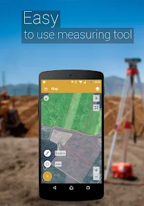
When it comes to measuring land, it is no longer necessary to carry a tape measure or measuring tape around. Today, having a good land measuring app is enough!
These apps are ideal for anyone who needs to take accurate measurements, whether for construction, gardening or implementing a decoration project. Fortunately, there are several options to meet these needs!
Top Dating Apps
What are you looking for?
Needing to measure a plot of land or space and not having a tape measure, ruler or any measuring tool is a common scenario.
However, it is now possible to leave traditional tools aside and use technology to solve this problem.
Thus, with an application to measure land, it is possible to measure areas, calculate the size of a plot of land and identify measurements in a simple, practical and direct way.
To do this, we detail how these apps work and what tools they offer. At the end of the article, you will find direct access to the official page of each application mentioned.
How does a land measurement app work?
Before we list the best land measurement apps, it is important to understand how they work.
First, most of these apps use technologies like GPS and augmented reality (AR) to calculate the size of areas quickly and easily.
This way, you just need to point your cell phone camera or mark points on the map to receive the desired footage from a land measurement application.
In addition, it is also possible to measure objects, determine the height of the terrain, discover the unevenness of the terrain and much more!
So, come and understand better how these tools simplify this process, beyond GPS and augmented reality:
- Marking Points on the Map: Many applications allow the user to select points on a digital map to mark terrain edges.
So, from these points, the app automatically calculates the total area and perimeter.
- GPS and Satellite: On large or difficult-to-access terrains, using GPS allows the app to map and measure the terrain based on location data.
Therefore, this functionality is especially useful in rural areas and can provide impressive accuracy, even in regions with poor visual coverage.
- Automatic Calculations: Once the boundary points have been defined or the area has been captured by the camera, the land measurement application automatically performs the calculations.
This way, you can find out the area and perimeter data in seconds on your cell phone screen.
Top 3 apps to measure land and make your life easier
We have listed the 3 best applications so that from now on you can measure any location with just a few clicks.
1. Area and Distance Meter
The Area and Distance Meter application uses the GPS mapping and measurement system for areas and distances quickly.
So, this land measurement app allows GPS tracking as you travel across the land, whether on foot or by car, perfect for those who carry out activities such as planting, harvesting and fertilizing.
Additionally, it is possible to share measurements via automatic links with captions, showing the desired area integrated with Google Maps.
How to download and use:
- First, access your cell phone's app store and, in the search bar, type “Area and Distance Meter”.
- Then, select the correct app and click Install or Get. Wait for the download and installation to complete.
- Finally, to start a measurement, choose between Measure Area or Measure Distance on the main screen of this land measurement app.
2.Geo Measure Area calculator
This is the free and accurate land measurement app that offers the exact calculation of the area or distance using GPS, recording your position as you travel the perimeter.
In addition to GPS, the application offers manual measurement mode, where you add markers on the map with one touch, adjusting them with the drag and drop function.
Additionally, Geo Measure stores and organizes your measurements, offers different types of map views, and allows you to export or import KML (Keyhole Markup Language) files.
How to download and use:
- First, through your cell phone’s app store, search for “Geo Measure Area Calculator” and install it.
- Open the app and tap the + button and then select between Area or Distance Measurement.
- Save and share your measurements via link or export in KML format.
3. Land area meter
Land Area Meter app uses high-precision maps to easily calculate the area of a plot of land or the distance between two points.
You can also search for specific addresses or locations for detailed measurements via built-in GPS technology that displays your location in real time.
Additionally, the app includes a digital compass for precise guidance, showing directions and data such as magnetic strength and altitude.
How to download and use:
- After downloading the app from your cell phone's app store, open it and choose between Area or Distance.
- To use manual measurement, simply tap on the map to create points and measure areas or distances. The app calculates automatically.
- When measuring by GPS, you need to activate the GPS to record your position in real time and calculate the distance as you move.
Advantages of Using Land Measurement Apps
Now that you know some of the best options in the land measurement app industry, we detail the main benefits of these tools:
- Practicality: There is no longer any need to carry tape measures and rulers. With your cell phone in your pocket, you have everything you need to measure land quickly and efficiently.
- Precision: Most of these apps use GPS and AR to get accurate measurements, which is essential for architects, farmers, and realtors who need accurate data.
- Time Saving: No more spending hours measuring every inch of land. In minutes, you can get all the information you need.
- Ease of Use: These apps are designed to be intuitive, even if you have no experience in measurements.
Take the next step: Try apps to view satellite images!
Did you like the practicality that a land measurement app offers and want to know about other incredible tools?
Know that it is possible to find applications that offer satellite images to travel the world, organize travel routes and even explore space!
Check out the article below for the best options when it comes to applications for viewing satellite images!
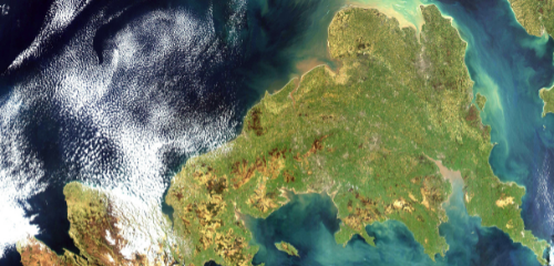
The best apps for viewing satellite images
Explore the world with just your cell phone. Discover the best apps for viewing satellite images!
You may also like

Bus travel apps: Savings and peace of mind
Discover how bus travel apps can bring savings, convenience and safety to your trips.
Keep Reading